Cypress Lookout viewpoint guide
Grouse Mountain Skyride Admission Ticket
What is Cypress Lookout and is it free?
Cypress Lookout is a free public viewpoint on the access road to Cypress Mountain in West Vancouver, reached by a short paved path from a parking pull-out. No ticket or admission is required, unlike the winter ski lifts higher up the mountain.
| Cost | Free |
| Where | Cypress Bowl Road, West Vancouver |
| Time needed | About 15 minutes round trip from the car |
| Getting there | Car only — no transit route |
| Best time | 20-30 minutes before sunset, or a clear morning |
Cypress Mountain gets talked about mostly as a ski resort, which means the free viewpoint partway up the access road gets overlooked by a lot of visitors who assume everything on the mountain requires a lift ticket. It doesn’t. Cypress Lookout is a short, paved pull-out with an unobstructed view over Howe Sound, the Strait of Georgia, and — on a clear day — Vancouver Island in the distance. It costs nothing, takes about fifteen minutes round trip from the car, and is one of the more reliable sunset spots on the North Shore precisely because so few tourists know it’s there.
Where it is and how to get there
Cypress Lookout sits on Cypress Bowl Road, the winding access road that climbs from Highway 1 up to the Cypress Mountain ski area parking lots. From downtown Vancouver, it’s roughly 25–35 minutes by car depending on traffic on the Lions Gate Bridge or Second Narrows — take Highway 1 west to Exit 8 (Cypress Bowl Road) and follow it uphill for about 6 km. There’s a marked pull-out with a small parking area partway up; from there, a short paved trail (well under 500 metres, flat and stroller-manageable in dry weather) leads to the viewing platform. There’s no transit route that gets you close — this is a car-only destination, which is part of why it stays quiet.
Unlike Grouse Mountain’s Skyride or the ski lifts at Cypress itself, there’s no gate, no ticket booth, and no operating hours to work around. The lookout is accessible any time the road is open, which in winter can depend on snow conditions — Cypress Bowl Road gets significant snowfall and occasionally requires chains or winter tires when the resort is running.
What you’ll actually see
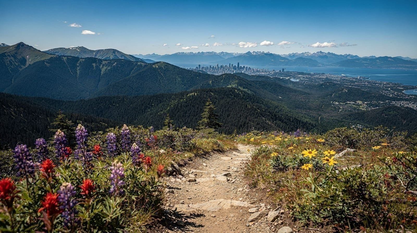
The view faces roughly northwest and west, taking in Howe Sound’s islands (Bowen Island is the most obvious), the container ships anchored in English Bay on clear days, and the sprawl of West Vancouver below. It’s not a summit view — you’re partway up the mountain, not at the top — but the elevation (a few hundred metres above sea level at the pull-out) is enough to put real distance between you and the city noise, and the framing through the trees gives it a more natural feel than the paved overlooks along the Sea-to-Sky Highway.
Sunset is the obvious draw. The lookout faces west enough that the sun drops toward Vancouver Island and the Gulf Islands, and because it’s a small, little-known spot, it rarely gets crowded the way, say, English Bay Beach does on a summer evening. Arrive 20–30 minutes before sunset to get a spot at the railing without waiting.
Daytime visits have their own appeal and shouldn’t be dismissed just because sunset gets all the attention. Midday light flattens the colour contrast somewhat, but visibility on a clear day is often better than at dusk, and you can pick out details across Howe Sound — ferries running the route to Bowen Island, sailboats out on the water, the more distant silhouette of Vancouver Island’s mountains on an especially clear afternoon — that get lost once the light starts fading. Bird activity around the forested edges of the viewpoint picks up in the early morning too, with songbirds and the occasional bald eagle riding the thermals off the mountainside visible from the railing if you’re patient and quiet for a few minutes.
Where the name comes from, and why there’s no cypress tree in sight
Despite the name, Cypress Mountain isn’t named for the tree most people picture — it takes its name from the yellow cedar (sometimes called Nootka cypress), a genuinely different species than the ornamental Mediterranean cypress most visitors know. You won’t find a labelled specimen at the lookout itself, but the broader mountain’s forest cover includes yellow cedar among the more common western red cedar and Douglas fir, part of the same coastal rainforest ecosystem that defines the rest of the North Shore’s mountains. It’s a minor point of local trivia, but worth knowing if you’re expecting a garden-variety cypress hedge and wondering why the surrounding forest looks like typical BC coastal woodland instead.
No ticket needed — and that’s the point
If you’re coming from a guide about Grouse Mountain or Capilano and expecting a bookable admission ticket for Cypress Lookout, there isn’t one, because there’s nothing to book. The lookout is a public viewpoint on a public road, not a managed attraction. What Cypress Mountain the resort does sell tickets for — the Skyride-equivalent lift access, snowshoeing, tubing — only operates in winter (roughly late November through March, snow-dependent), and none of that overlaps with the lookout itself.
If your trip includes wanting a paid, staffed North Shore attraction with a photo-friendly summit and consistent hours, Grouse Mountain’s Skyride is about 15 minutes away by car and runs year-round. It’s a genuinely different experience — an enclosed tram ride to a staffed alpine summit with a bear refuge and restaurant, versus a five-minute walk to a quiet railing — but the two pair reasonably well if you’re spending a full day on the North Shore.
Alternatively, Capilano Suspension Bridge Park sits about 20 minutes east and offers a very different kind of paid nature experience (canopy walkways over a river gorge) if the free lookout leaves you wanting more structured activity.
Cypress Mountain beyond the lookout
The lookout is just one stop on Cypress Bowl Road. Further up, the road ends at the ski area base, which in summer becomes a trailhead for several genuinely good hikes — the trail up to Cypress Mountain’s alpine viewpoints and the connector trails toward Black Mountain both start from the same upper parking lots. If you’ve driven all the way up for the lookout, it’s worth continuing another few minutes to see what the summer trail network looks like, even if you don’t plan to hike far. Parking at the upper lots is free outside ski season and rarely fills up on weekdays, though summer weekends can get busy by late morning.
For a fuller comparison of how Cypress stacks up against the North Shore’s other mountain options, see our Grouse vs. Cypress vs. Seymour breakdown — it covers which mountain suits which kind of visitor, since the three get lumped together a lot but serve pretty different purposes.
Common mistakes first-time visitors make
The most frequent one is timing: arriving right at sunset rather than 20–30 minutes before it, and finding the small pull-out already full or the best railing spots already taken. The second is confusing Cypress Lookout with the ski resort’s summit views — visitors sometimes drive all the way up Cypress Bowl Road expecting the lookout to be at the very top, near the ski lifts, when it’s actually a lower, roadside stop partway up; if you’re aiming specifically for the lookout, don’t drive past it toward the upper parking lots by mistake, since the two are genuinely different stops with different views.
The third is underestimating the temperature difference — visitors who leave downtown Vancouver on a warm evening in shorts and a t-shirt are often surprised by how much cooler and windier it feels at the railing once the sun starts dropping, particularly in shoulder seasons.
It’s also worth setting expectations correctly: this is a good, solid viewpoint, not a jaw-dropping, once-in-a-lifetime vista on the scale of Vancouver’s very best outlooks. It earns its place on a West Vancouver itinerary because it’s free, quick, and quiet — not because it’s a bucket-list must-see that justifies a special trip on its own merits.
Getting there without a car
This is the one honest weak point of Cypress Lookout: there’s no realistic transit option. Cypress Bowl Road has no bus service, and it’s steep enough that walking up from the nearest transit stop on Highway 1 (even if you found one close enough) would turn a fifteen-minute stop into a multi-hour uphill slog on a road with no pedestrian shoulder in places.
Visitors without a car have two realistic options — a rideshare or taxi from downtown or West Vancouver, which will run considerably more than a Skyride ticket by the time you factor a return trip, or renting a car for the day if you’re planning to see several North Shore spots that share this same access problem. If you’re relying on transit for your whole Vancouver trip, it’s more efficient to prioritize Grouse Mountain or Capilano, both of which have workable bus connections, and treat Cypress Lookout as something you visit only if a car happens to be part of your plans anyway.
Photography notes
Cypress Lookout’s railing is wide enough for a handful of tripods without anyone getting in each other’s way, which isn’t always true at more famous viewpoints. A wide-angle lens captures the full sweep of Howe Sound, but a short telephoto is worth having too — Bowen Island and the more distant Gulf Islands compress nicely and make for a more layered composition than the wide shot alone.
Golden hour light hits the water directly, and because the viewpoint faces roughly west, you get usable light for 20–30 minutes after the sun itself drops below the horizon, which is often when the sky colour is at its best. Bring a light jacket if you’re planning to linger for blue hour afterward — temperatures drop quickly once the sun is gone at this elevation.
Is it worth it for families or less mobile visitors
Yes, with the caveat that a car is required to get there at all. The paved path from the parking pull-out to the viewing platform is short and largely flat, manageable for most strollers in dry conditions and for visitors who’d struggle with a longer hike. There’s no fence directly at every angle of the viewpoint, though, so supervising small children near the railing edge is a reasonable precaution rather than an overreaction. Wheelchair users should know the path, while paved, has a couple of mild grade changes and no formal accessibility rating — it’s worth a cautious approach rather than assuming full accessibility, since Metro Vancouver’s regional park facilities vary in how rigorously they’re maintained to that standard.
Practical notes
Parking: The pull-out for the lookout itself has limited space — maybe 15–20 vehicles — and while it rarely fills, sunset hours on clear summer evenings can mean circling once or twice. The larger lots further up at the ski area base are a fallback if the lookout pull-out is full; from there it’s a slightly longer walk but the same general vantage.
What to bring: Nothing beyond decent shoes for the short paved trail, and a layer — Cypress Bowl Road gains real elevation, and it’s routinely 3–5°C cooler than sea-level Vancouver, more if wind picks up at the railing.
Season: Accessible essentially year-round when the road is open, though winter storms occasionally close Cypress Bowl Road entirely or require winter tires/chains, since it also serves the ski resort. Spring and fall bring the fewest crowds and often the clearest air, since summer haze from wildfire smoke (a real possibility in late July–September some years) can dull the long-distance views.
Facilities: None at the lookout itself — no washrooms, no food, no cell coverage guarantee. The ski area base further up has washrooms and a cafeteria, but only reliably staffed during ski season; expect them closed or minimally operating in summer.
Food and coffee: There’s nothing at the lookout, so plan around it. West Vancouver’s Ambleside and Dundarave neighbourhoods, back down toward the water, have cafes and restaurants worth stopping at either before the drive up or after coming back down — a reasonable way to bookend a sunset visit rather than arriving hungry and having nowhere to eat nearby. Bringing a thermos of coffee or tea for the viewpoint itself is common among regulars, since there’s genuinely no vendor of any kind on Cypress Bowl Road below the ski area base.
Cell coverage: Patchy at best along Cypress Bowl Road and at the lookout itself, improving somewhat back down near Highway 1. Download offline maps or directions before heading up if you’re relying on a phone for navigation, since losing signal partway up a winding mountain road is a genuinely common experience here.
Nearby options if you want more
West Vancouver has several other free, low-effort viewpoints worth knowing about if Cypress Lookout appeals to you. Lighthouse Park, about 20 minutes further along the coast, offers old-growth forest and rocky shoreline viewpoints with a similarly uncrowded feel, and it’s a stronger choice if you want a longer walk rather than a quick roadside stop. Mount Seymour, on the North Vancouver side rather than West Vancouver, is the third North Shore mountain in this category and has its own alpine viewpoints reachable by a genuinely short trail from its own parking area.
If you’re weighing whether Cypress Lookout is worth the drive on its own versus folding it into a bigger North Shore day, it works best as an add-on: a 20–30 minute detour on your way to or from Cypress Mountain’s summer trailheads, or a dedicated short trip specifically timed for sunset. It’s not, on its own, worth a special drive from downtown if your time in Vancouver is limited and you have to choose between it and a staffed attraction like Grouse or Capilano — but if you’re already in West Vancouver for the day, it costs you almost nothing to add.
Building it into a full West Vancouver day
Cypress Lookout works well as the closing stop on a West Vancouver day rather than the centerpiece of one, largely because of its no-transit, short-visit character. A reasonable itinerary: spend the morning in West Vancouver proper, browsing the shops and waterfront around Ambleside or Dundarave, continue to Lighthouse Park in the early-to-mid afternoon for a longer forest walk, then finish at Cypress Lookout timed for sunset before heading back downtown.
That sequence keeps the driving efficient — all three stops sit along or just off Marine Drive and the same general corridor — and avoids the common mistake of treating Cypress Lookout as a standalone destination worth a dedicated round trip from downtown on its own.
Visitors staying on the North Shore rather than downtown have it easier still, since the drive up Cypress Bowl Road from a North Vancouver or West Vancouver hotel can be under 20 minutes, making a quick sunset visit a realistic after-dinner outing rather than a planned excursion. Either way, checking a sunset time table before you go is worth the two minutes it takes — arriving at the lookout after the sun has already dropped defeats the entire point of the trip, and West Vancouver’s tree cover on the access road means you won’t get much warning of how the light looks until you’re actually at the railing.
Frequently asked questions — Cypress Lookout viewpoint guide
How much does it cost to visit Cypress Lookout?
Nothing. It's a free public viewpoint on the access road to Cypress Mountain, reached by a short paved path from a parking pull-out — no ticket, gate, or booth of any kind.Do I need a car to reach Cypress Lookout?
Yes. There's no bus service on Cypress Bowl Road, so a car, rideshare, or taxi is the only realistic way to get there. Visitors without a car are better served prioritizing Grouse Mountain or Capilano, both reachable by transit.
Top experiences
Bookable activities with verified prices and instant confirmation on GetYourGuide.